

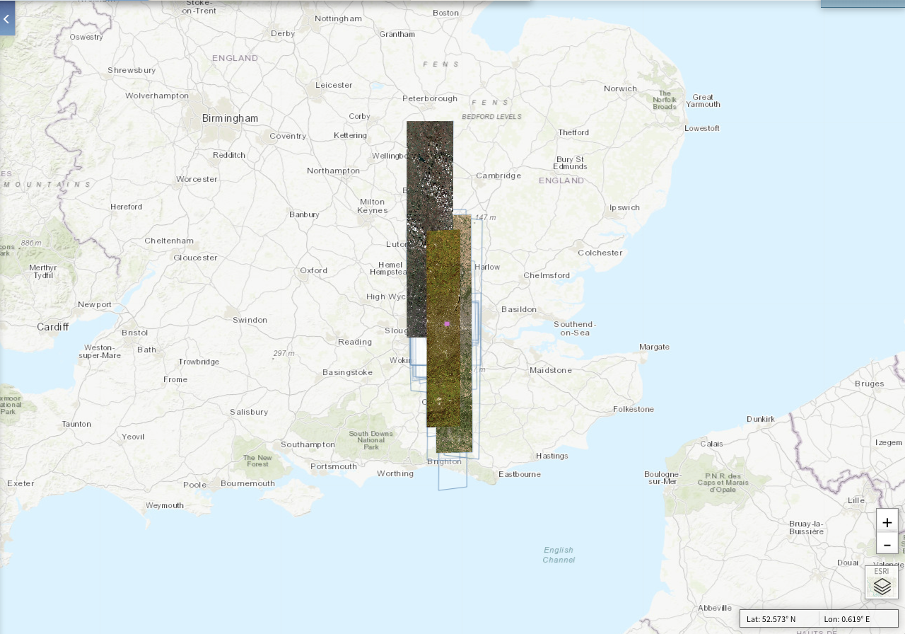
Satellite Image Capture
As satellites orbit the earth, their sensors are pointed down towards the ground with the sensor capturing what it “sees”. Once the data is downloaded we typically end up with very large 'swathes' of imagery that look like long strips.
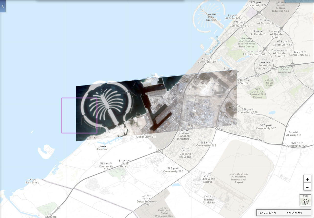
Edge/Corner of Strip
With these resulting strips, we typically will end up with edges along the side of the strip and corners where the strip ends - either where the sensor has stopped capturing data or where the strip has been “cut” to make it easier to process the data.
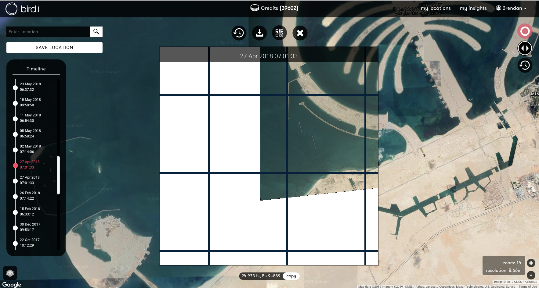
Strips to Tiles
To render these large strips on a web map, we’re required to to cut the strips up into multiple “tiles”, typically 256x256 pixels. Given the rhomboid nature of the strips, and the equilateral nature of the web map tiles, cutting perfect shapes won’t quite work along the edges, or the corners of the image strip. Any areas within the 256x256 tile that can’t be completed with satellite data is typically filled in with white or “no data”.
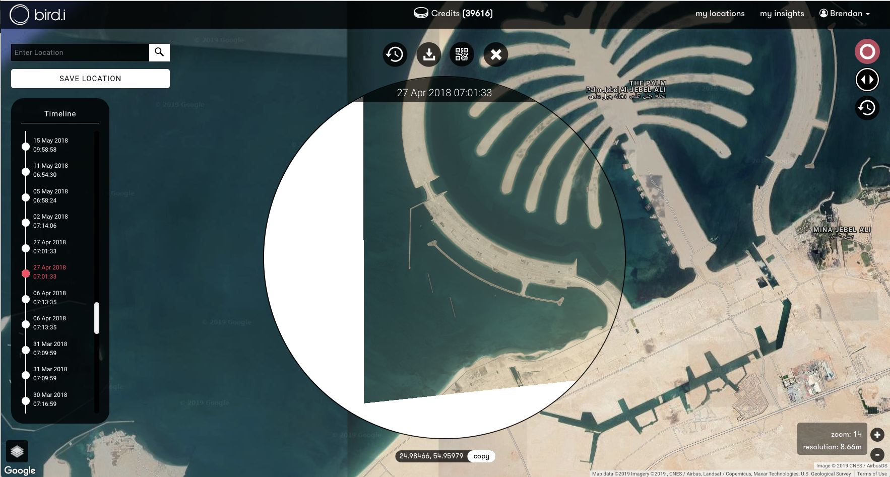
Bird.i Image Viewer
In order to fully demonstrate that a strip is on the edge, the Bird.i ImageViewer will add extra white tiles to the viewer so that you can get the full extent of the captured image strip.
Have a question about satellite imagery? Check out our FAQs here or contact us.
